On the morning of July 12, 2016, Joan Elias awoke to discover she was stranded in her home. Elias, who lives on 21 mostly-wooded acres in rural Iron County, was cut off from the outside world by an unexpected — and unprecedented — deluge.
A powerful storm system rolled in the night before and stalled over northwestern Wisconsin. In many locations it delivered a torrent of rain measuring 10 or more inches — a typical summer's entire rainfall — in only 8 hours. Some locations in southern Ashland County received 14 inches of rain.
The landscape surrounding Elias' home, within the town of Gurney, is a patchwork of forests and hayfields growing on clay soils that predominate beneath a wide expanse of northern Wisconsin. Clay is slow draining, so much so that it's commonly used to line artificial ponds. The ground was already saturated by previous storms, meaning the clay had become a virtual region-wide plug for rain.
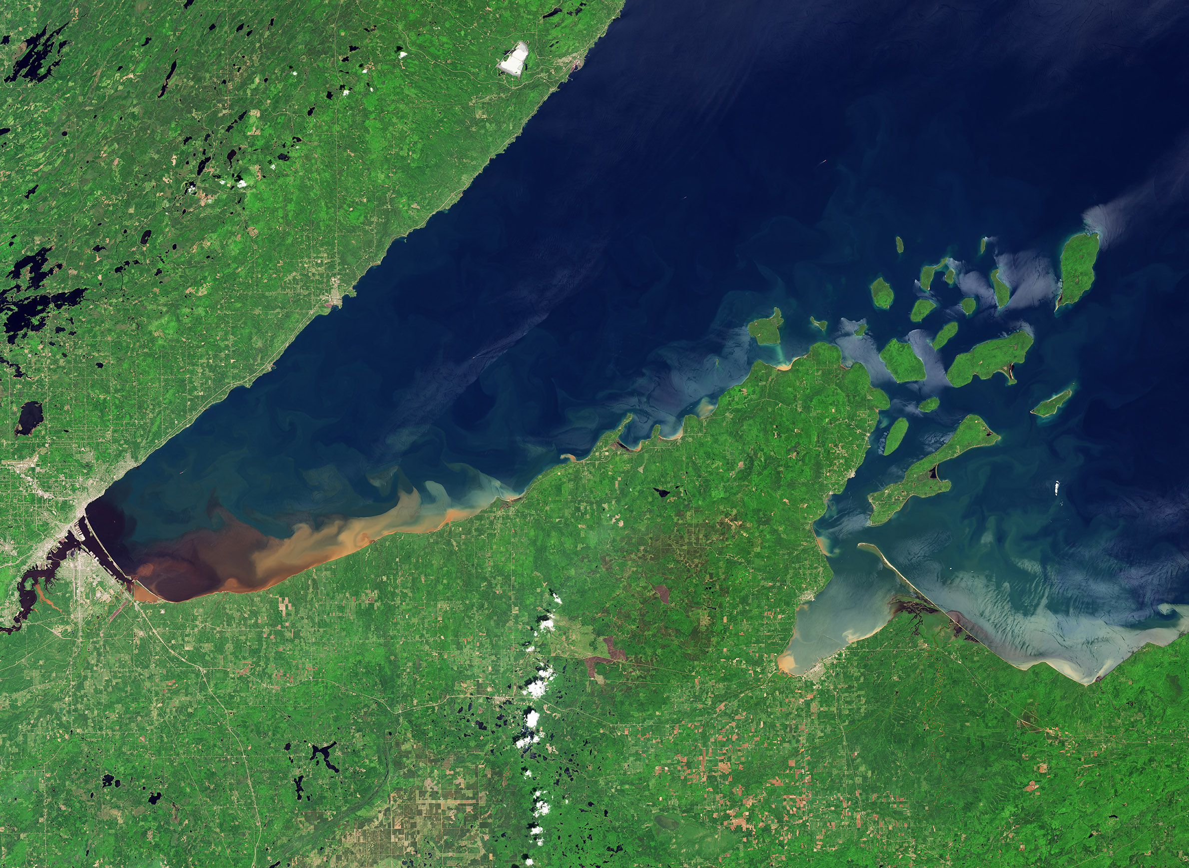
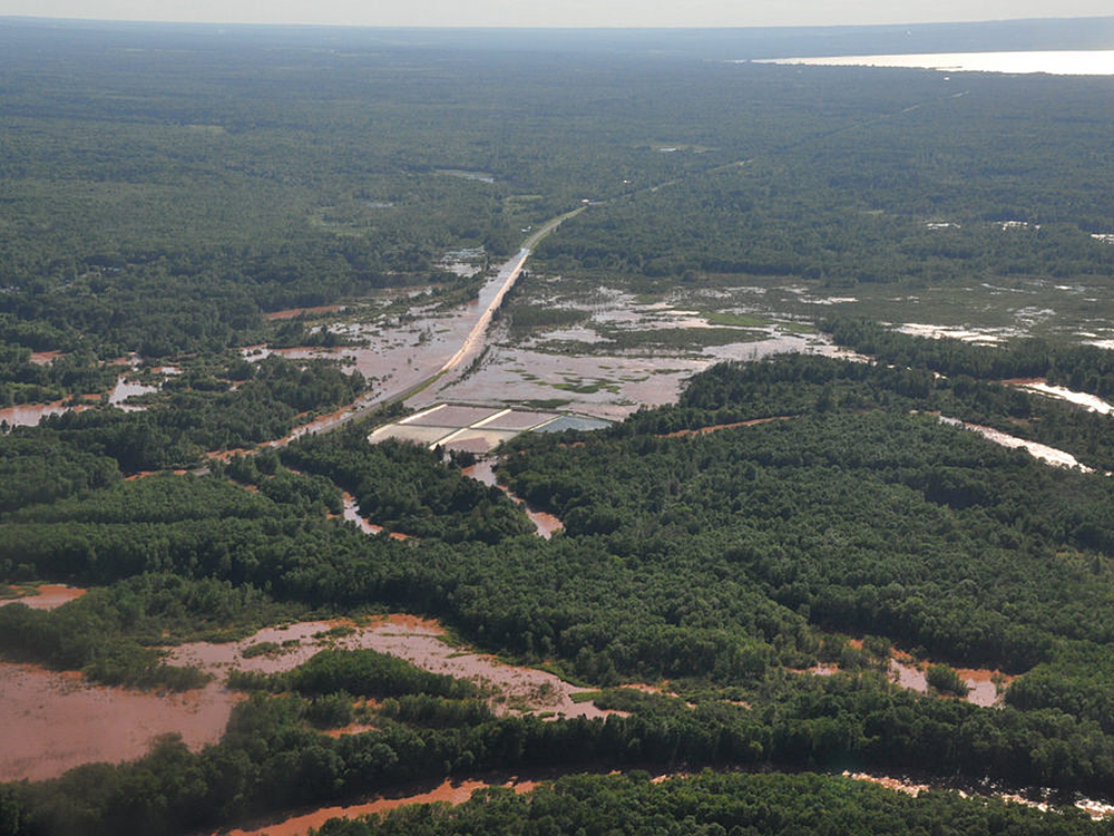
With nowhere else to drain, the rainfall choked streams and rivers with swirling runoff that resembled creamy tea, laden with the clay sediment and rich with red iron oxides. The water that rushed toward Lake Superior would reach volumes previously unheard of in many local riverbeds.
Notable among these waterways was the Bad River, which drains about 1,000 square miles of northern Wisconsin into Lake Superior. Between 8 p.m. on July 11, when the storm system moved in, and 11 a.m. the following morning, the volume of water flowing through the Bad River in Odanah skyrocketed from 300 to 40,000 cubic feet per second — a 130-fold increase.
The Bad River's watershed includes Vaughn Creek and another small creek near Elias' property in Gurney. By daybreak, those creeks, which are typically a lazy trickle in July, had swelled into sizable flows, making the roads surrounding her home impassable.
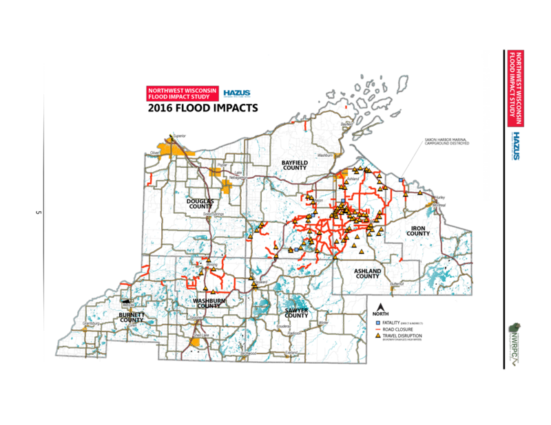
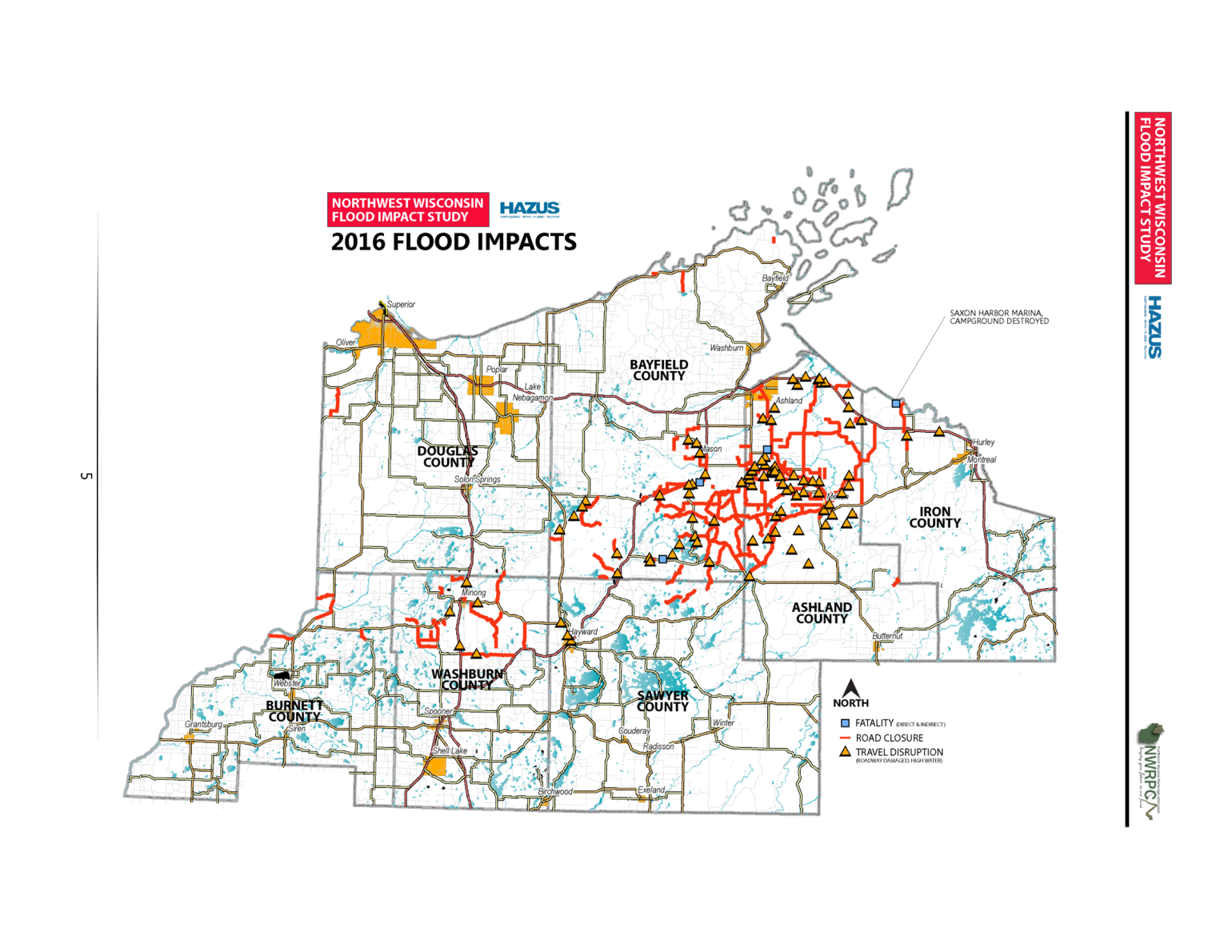
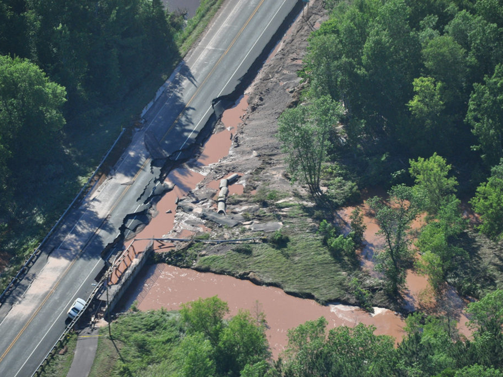
But it wasn't simply a temporary flood that separated Elias and her neighbors from the surrounding world. Over the course of the day it became clear that the churning waters had devastated the local road network, and the damage was spread well beyond Gurney. Hundreds of washouts on roads across northwestern Wisconsin had cut off thousands of residents and visitors from workplaces, grocery stores, emergency services and medical care, all during the height of the summer tourist season.
Saxon Harbor, a popular campground and marina on the south shore of Lake Superior about 10 miles north of Gurney, was destroyed. At the nearby reservation of the Bad River Band of Lake Superior Chippewa, including the community of Odanah near the mouth of the Bad River, the flooding also caused extensive damage to homes, businesses and infrastructure. Across the region, major highway closures made travel even for residents who could leave their homes extremely difficult. In all, four people lost their lives across the region due to the storm and resulting floods.
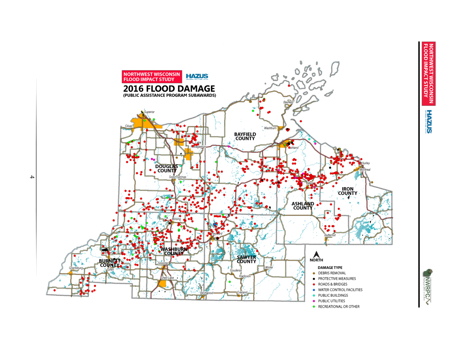
Flood damage to property, roads, bridges and other infrastructure stretched from Wisconsin's border with Michigan's Upper Peninsula westward across Iron, Ashland, Bayfield, Sawyer, Washburn, Douglas and Burnett counties, an area encompassing nearly 10,000 square miles. Wisconsin Emergency Management documented the widespread devastation near Lake Superior and areas farther inland with extensive aerial surveys.
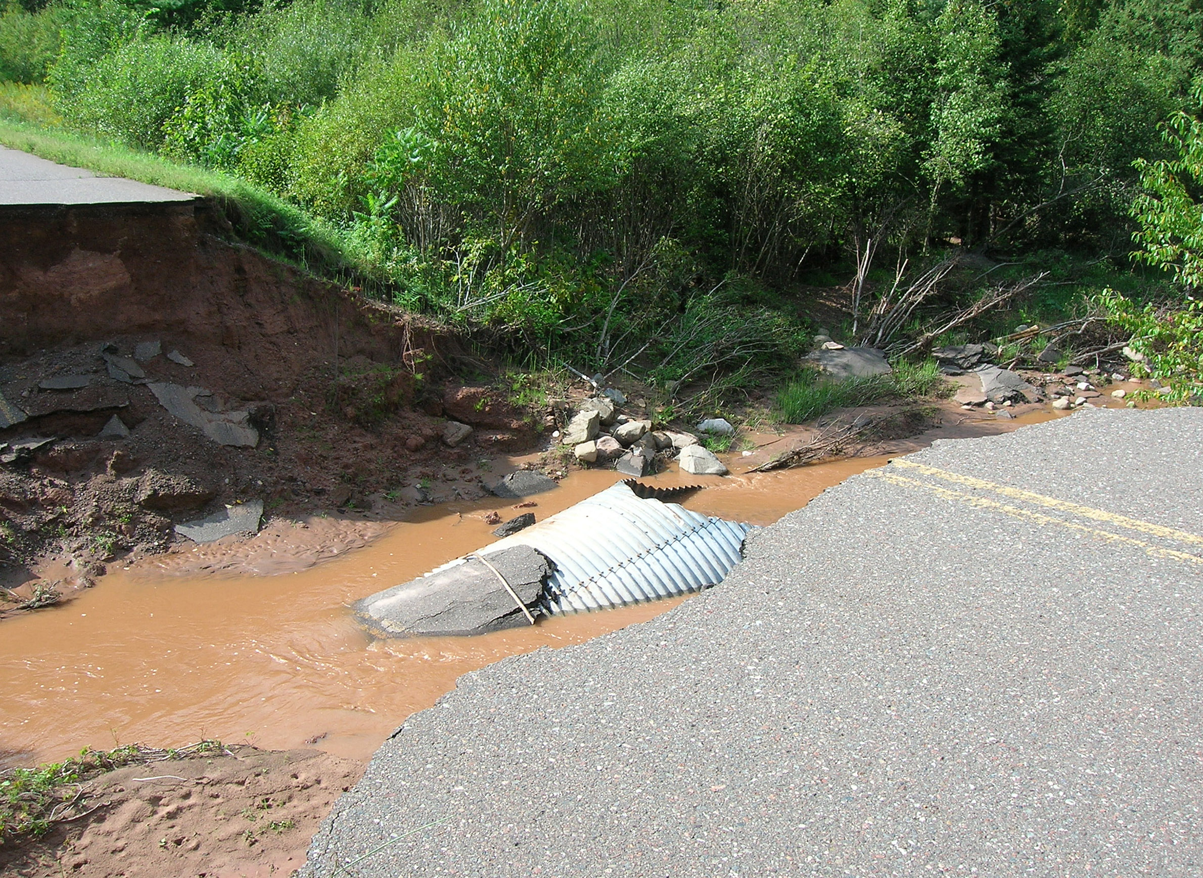
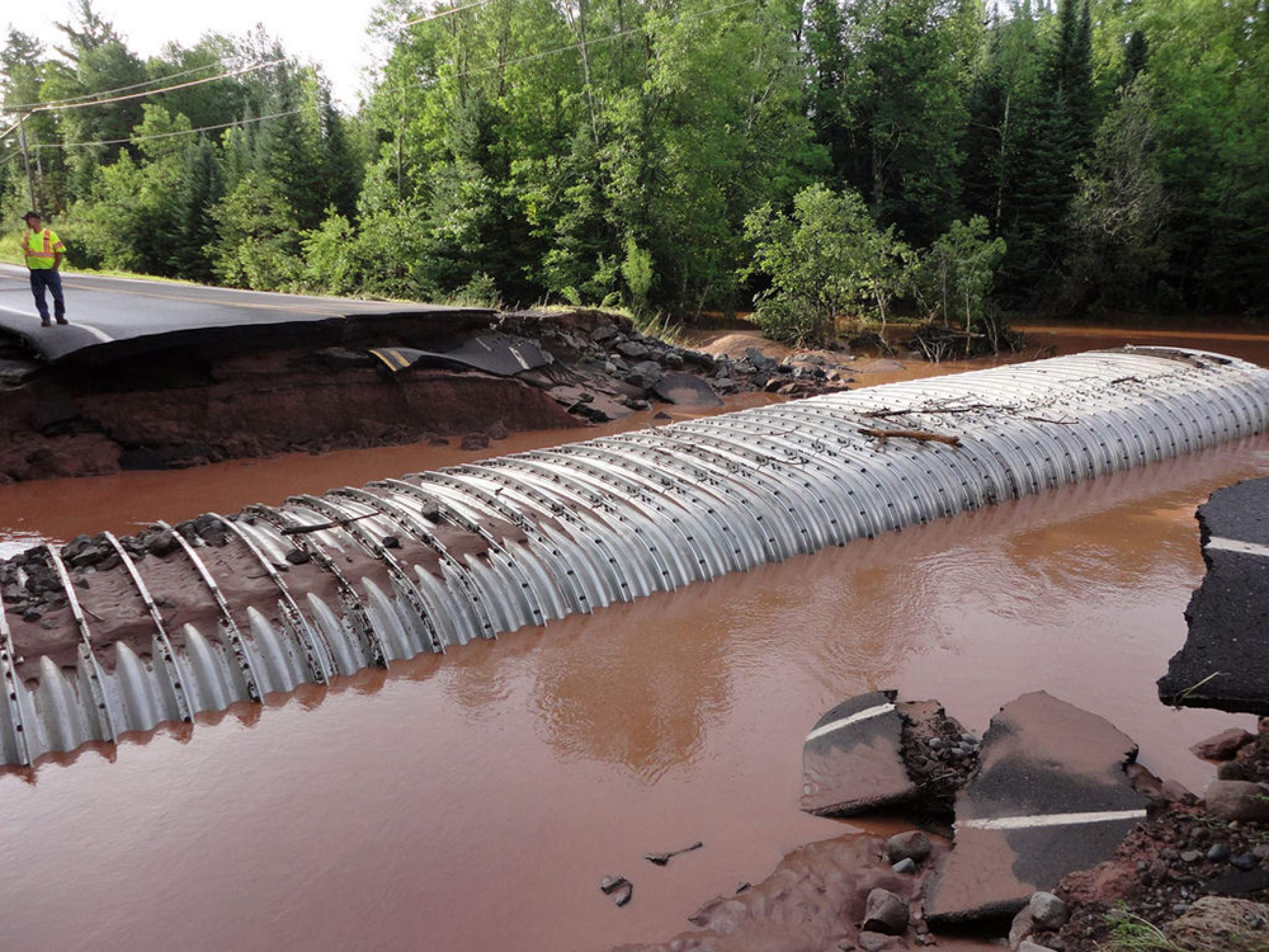
A majority of the road washouts resulted from failed culverts, the concrete or steel pipes that route streams beneath roadways. Most of the culverts had been installed decades prior to the 2016 storm under engineering guidelines that had not considered the possibility of a deluge of this magnitude.
The culverts were too narrow to handle the vast volumes of water racing through the watershed. Many became clogged with debris. Where they failed, churning floodwaters backed up and ate away at the roadway above. In many townships few routes were spared.
More than a dozen of these washouts were in Gurney.
"We couldn't go anywhere," Elias said. "My neighbors and I were stuck."
One of those neighbors had lung cancer and badly needed oxygen.
"He was stranded," said Elias. "So some of our other neighbors took it upon themselves to get him out by blazing a trail through the woods and fields. We all used that path until we could get out by the road, which was a week."
Within that week, crews hastily repaired enough roadways throughout the region so that isolated residents like Elias and her neighbors could at least get to and from their homes. But the work was only beginning.
State and federal authorities declared the floods a major disaster, freeing up funds for rebuilding, and local officials quickly began making damage assessments and applying for grants to rebuild and replace washed out infrastructure. Major detours would linger, however, as state highways and other major connectors remained closed for weeks or months.
Over the subsequent weeks, months and years, communities across northwestern Wisconsin would continue the rebuilding process, though their efforts have often come up against practical, budgetary and bureaucratic barriers, including federal and state rules that can incentivize short-sighted planning by encouraging and even stipulating that infrastructure be rebuilt as it was prior to the disasters. This requirement in particular has been a source of frustration for communities in northwestern Wisconsin — and elsewhere — attempting to construct more resilient infrastructure, including roads that can withstand an uncertain but assuredly wetter future in the Midwestern United States.
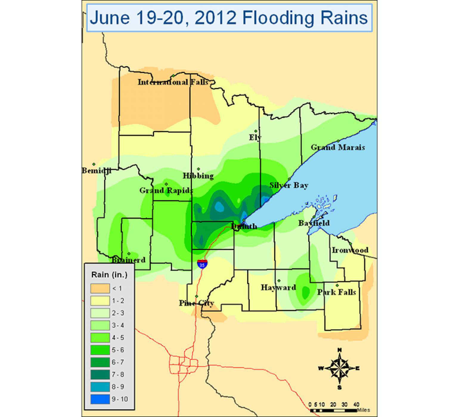
The 2016 flood followed a similarly intense storm in June 2012 that caused heavy flood damage in northeastern Minnesota, but also affected northwestern Wisconsin, including in the city of Superior in Douglas County, as well as western Bayfield County. After another major flood hit the region in 2018 — a flood that damaged roads at many of the same locations that washed out in the 2016 disaster — the local search for solutions has taken on more urgency.
Warnings of repeat disasters
Chequamegon Bay is a large, shallow inlet on Lake Superior's southern shoreline. The bay is protected by the Apostle Islands archipelago and Chequamegon Point, and for centuries has been a center of settlement and commerce.
In the late 19th century, the cities of Ashland and Washburn sprang up along the bay's shores as local centers of northern Wisconsin's timber and mining industries. Today, the two cities are home to more than 10,000 people, and thousands more live and work in surrounding tourist, farming and Lake Superior Chippewa tribal communities. The region is also a gateway to the Apostle Islands National Lakeshore, which in 2015 drew nearly a quarter-million tourists who spent $36 million in communities surrounding the park, according to the National Park Service.
The region largely developed before there was any scientific understanding of the interplay between weather, climate, ecosystems, land use and infrastructure. Settlers clearcut ancient forests and drained wetlands, both of which greatly reduce surface water runoff, to make way for farms and villages and a network of roads to connect them. In doing so, they at once built a local economy and set the stage for future problems.
In addition to its historic importance, Ashland is also home to Northland College, a small liberal arts school founded in 1892. Northland is part of an intercollegiate group of campuses that emphasize the environment called "EcoLeague," and the college prioritizes environmental sustainability, both in its academic programming and its operations. Northland faculty have helped lead the charge locally to address the region's vulnerability to climate change, and have at times offered blunt assessments of the problem.
"Chequamegon Bay is arguably the least-climate-adapted spot in the country from an infrastructure viewpoint," said Randy Lehr, a former Northland professor of sustainable development, in a 2014 interview with Wisconsin Sea Grant. Lehr is now dean of science and math at Sierra College in Rocklin, California.
Lehr went on to make a startling pronouncement: Precipitation estimates for the region, which engineers had for decades used to locate and size culverts, bridges and ditches, were woefully inadequate.
"As we've learned more about how weather patterns set up around here, we were way off — 40-50% off on precipitation estimates on the lower side," Lehr said at the time, adding that climate-change-driven extreme precipitation was likely to exacerbate the problem as the years unfold.
It wouldn't take long for Lehr's warnings to bear out.
Probability in action
The July 2016 flood caused more than $38 million in damage to local infrastructure, much of it due to inadequately sized culverts, according to local officials. In various places, the precipitation and resulting floods were deemed indicative of a "100-year," "500-year" or even "1,000-year" event, terms that can lead to confusion.
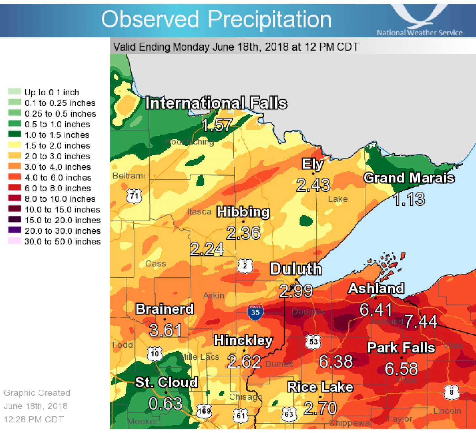
For instance, a similarly extreme storm in June 2018 wreaked havoc in many of the same locations, even as construction crews remained in the midst of repairing damage from 2016. The 2018 storm and floods were in some places considered a "1,000-year" event and caused an estimated $13 million in damage to infrastructure, prompting yet another federal disaster declaration.
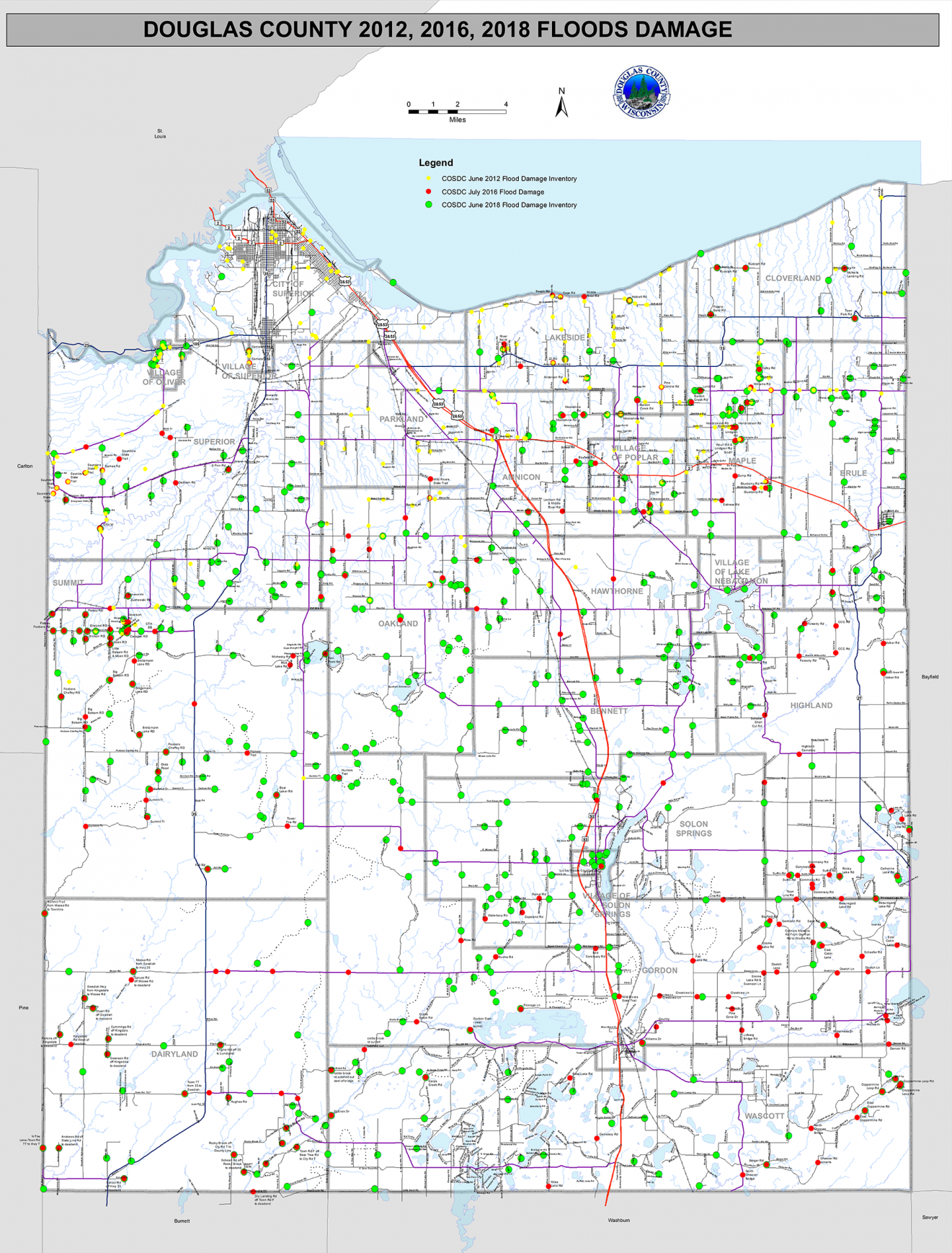
The 2016 and 2018 storms themselves followed a "100- to 500-year" storm in 2012 that caused major flood damage in Douglas and Bayfield counties and parts of Minnesota. Some communities, such as the town of Maple in eastern Douglas County, faced damage to the exact same stretches of road after each successive storm in 2012, 2016 and 2018.
Now, residents and local leaders are left pondering how the region has been pummeled with so-called 100-year or larger storms three times in six years.
"I have personally seen four 100-year storms" since the 1980s, said Tom Innes, who has been chairman of the town of Gurney since 1990. "And whatever this last storm was called — some people call it a 500-year storm, some people call it a 1,000-year storm — I don't know what it is, but I'm not four or five hundred years old."
Part of the issue is that the terms "100-year flood" or "500-year storm," are colloquial and imprecise shorthand for probability calculations. A "100-year" storm or flood is one that, based upon historical precipitation or stream gage data for a given location, has a one in 100 (or 1%) chance of occurring in that location over a 24-hour period in any given year. Similarly, a 500-year storm or flood has a 0.2% probability of occurring in any year, while a 1,000-year storm has a 0.1% chance. Simply because such storms have a low probability of occurring in any single year does not keep them from occurring in quicker succession than their names suggest.
Moreover, the storms in 2012, 2016 and 2018 were geographically massive events with widely differing precipitation totals across northwestern Wisconsin. What may have qualified as a "1,000-year" storm in one location could have nearby amounted to a much lower precipitation total and not even qualify for the "100-year" label.
Confusing terminology aside, Randy Lehr pointed out in 2014 that the probability calculations for these low-frequency, high-intensity storms were significantly underestimated in the region for decades. Because these estimates are one of the variables engineers use to calculate culvert sizes, the underestimation had disastrous consequences.
Keeping pace with precipitation
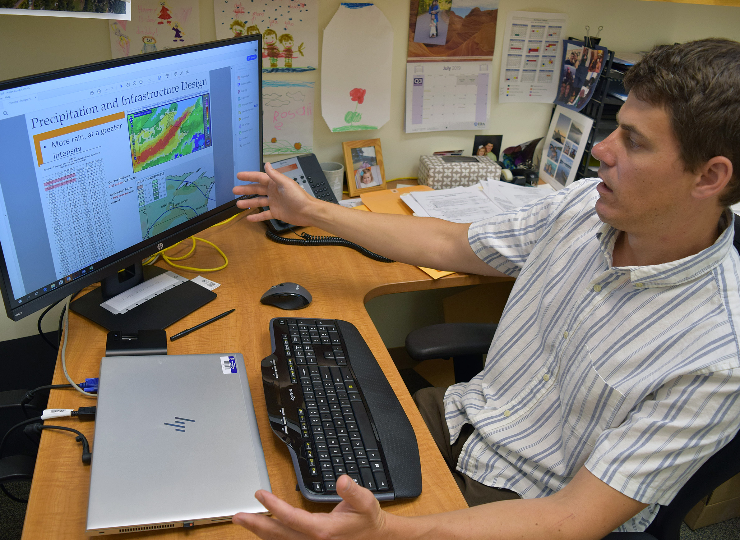
Scientists in the region are helping local officials better understand how they can try to minimize the impacts of the next disaster. One of those scientists is Matt Hudson, associate director of the Mary Griggs Burke Center for Freshwater Innovation at Northland College, a role Lehr previously held.
Hudson and his students monitor streamflow and water quality in Chequamegon Bay tributaries, as well as water quality in the bay itself. They're building a long-term dataset that Hudson hopes will inform future decisions related to local infrastructure and land use. Concern about the bay's water quality has grown since the 2016 and 2018 floods filled it with huge volumes of sediment and wastewater.
"The big thing people notice after a flood event is all of a sudden the bay turns brown, and nobody wants to be out there fishing or swimming, and people become concerned about water quality issues," Hudson said.
Hudson has increasingly served as an unofficial advisor to local officials who are trying to rebuild and improve the regional infrastructure system so it better withstands major storms in the future. Any large storm will send runoff into Lake Superior, but preventing washouts can help minimize environmental damage, as well as the cost of rebuilding.
Hudson explained that roads in the region have long been built under "100-year" storm guidance first developed in the 1960s and '70s and based on historical data from the mid-20th century. Updated estimates, available via the National Oceanic and Atmospheric Administration's Atlas 14 precipitation tool, factor in precipitation records through October 2011.
In northern Wisconsin, the newer estimates significantly increase the precipitation associated with storms that have a 1% chance of happening each year. For instance, in Ashland the previous estimate for such a storm was 5.4 inches of rain in a 24-hour period. The new estimate puts the total at 7.33 inches, more than one-third additional rainfall.
"And that doesn't include data from 2012, 2016, and 2018, when we had these large events," Hudson said. "So that current guidance from Atlas 14 is probably already outdated."
Factor in ongoing climate change effects, and the problems of planning infrastructure for future conditions becomes all the more difficult.
"What do we build for? What do we expect in the future? It's really uncertain," Hudson said. "It makes it really difficult to provide guidance."
Hudson hopes long-term streamflow monitoring can help, as well as climate models that point to more frequent large-scale storms.
Local officials who are responsible for rebuilding roads, meanwhile, hope they're able to make enough improvements to withstand more big storms when they come. But for many it has been a struggle.
The difficulties of rebuilding
The seven counties in northwestern Wisconsin that have borne the brunt of the repeated storms and floods since 2012 are home to 124 townships and many more municipalities. Each of these townships, cities and villages is responsible for maintaining local roads within its borders. For the dozens that have recorded washouts and other damage due to flooding, a major challenge has been not only to repair the damage but to reinforce the roads so future floods aren't as destructive.
Funding is the largest barrier these communities face. In some circumstances, the damage from a single storm can exceed a township's entire annual revenue, as happened in Gurney following the 2016 flood, according to town chair Tom Innes. This isn't a difficult feat when most townships bring in a few hundred thousand dollars or less in annual tax revenue and the cost to repair a single washed out culvert can exceed $100,000. Even in places where damage is not so expensive, barriers abound to building more resilient roads.
For instance, most townships and smaller municipalities do not employ engineers with the technical skills required to plan major roads projects. One consequence of this: For decades, some townships installed culverts that were too small even under the old 100-year storm guidance, instead favoring less expensive options.
The problems that small culverts cause are two-fold. First, they are more likely to fail even after a smaller storm. Second, when they're replaced using federal cost-share programs like those through the Federal Emergency Management Agency, local officials often have no choice but to replace them as they were prior to the disaster, thanks to a FEMA rule that requires rebuilding damaged infrastructure to its previous specifications.
Following the 2016 and 2018 floods, Ashland County's Highway Commissioner Emmer Shields assisted local townships with their damage assessments and rebuilding plans. He described the frustration of encountering the same problem again and again: woefully undersized culverts that had failed and were replaced with culverts, also called pipes, of the same size.
"We were looking at these pipes and saying, 'Well, okay, no wonder it failed,'" Shields said. "'Even for a normal 100-year storm, or a 50-year storm, or a 25-year storm, this thing was way undersized, so it's pretty obvious why it failed. I'm surprised it lasted as long as it did.' But you go to FEMA, and they say 'Oh no, we only will pay for replacing it the way it is.' So if you've got a 24-inch pipe that's buried 20 feet down, you go to all that trouble of excavation and replacement and then put another 24-inch pipe in. It is just really ridiculous.”
Shields is hardly alone in expressing these concerns. WisContext interviewed more than a dozen local and county officials in Douglas, Bayfield, Ashland, Iron and Sawyer counties in July 2019 about the constraints that keep them from building more resilient road infrastructure following washouts. All of them identified funding and the FEMA rule as two top barriers.
"It's basically a 'Band-Aid' that's just going to cause future problems that cost more money," said Martin Laasko, a supervisor for the town of Maple, about the FEMA rule.
But in most communities there is simply no viable alternative.
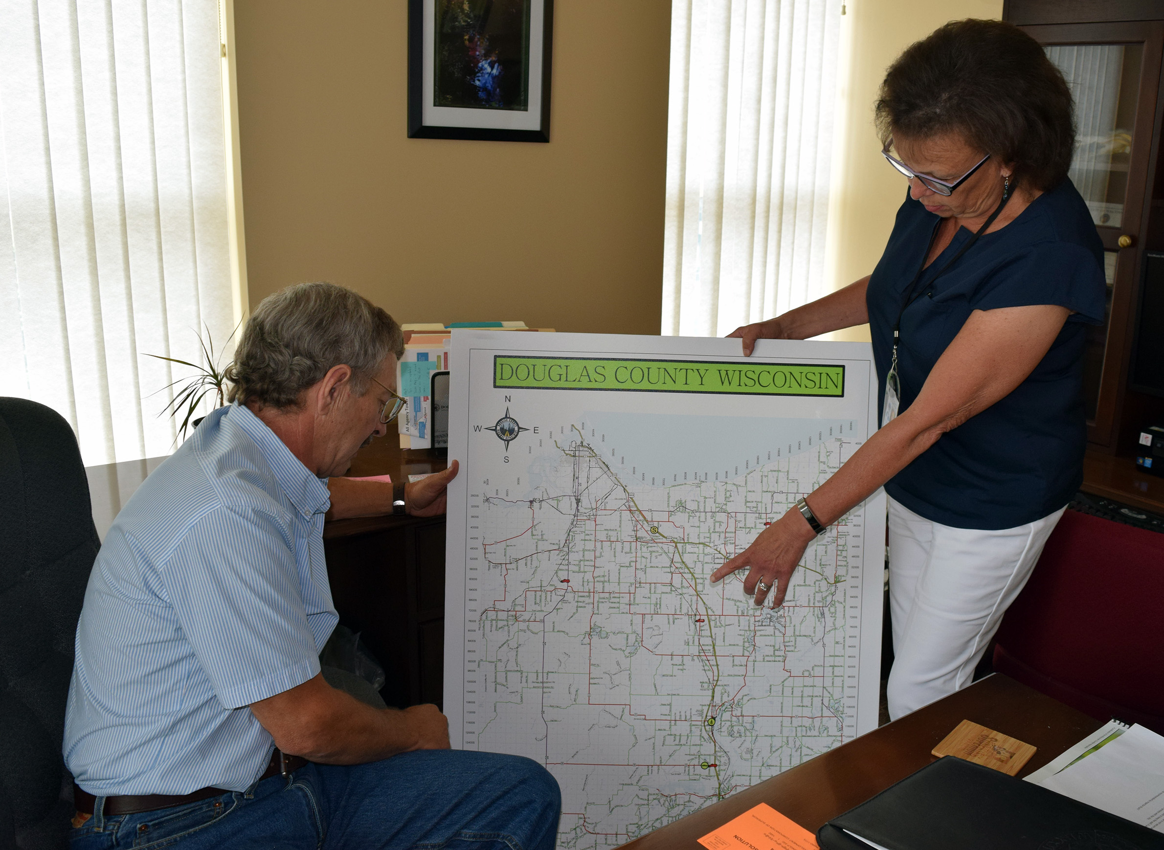
"We don't have the money," said Mark Liebaert, chair of the board of supervisors for Douglas County. Liebaert described FEMA funding as a sort of catch-22 for cash-strapped local governments that can't even keep up with basic road maintenance on their own, let alone repair and upgrade damaged infrastructure.
"Even if we're smart, which I assume sometimes we are smart enough to recognize that it might not be the best to keep putting back [the same infrastructure that was washed out], we don't have the money to do anything different," he said.
Liebaert blamed state-imposed levy freezes on county governments for part of the funding crunch, adding that the opioid epidemic has helped blow a gaping hole in Douglas County's annual budget in recent years. He said the county has had to transfer hundreds of thousands of dollars out of its highway budget to cover costs associated with the addiction crisis.
"We're decreasing the highway budget at a time when we need to increase the highway budget," he said.
To be sure, counties and townships are not alone. The state has stepped in to help rebuild after the successive floods. Wisconsin's Department of Transportation and Department of Natural Resources have provided technical assistance and grant funding to rebuild lost or damaged infrastructure, including a $1 million grant to help rebuild Saxon Harbor. The marina is scheduled to reopen in August 2019 after three years of rebuilding.
Still, the state has long dealt with its own transportation budget crunch and is hardly in a position to fund all of the upgrades that local officials say are necessary.
Meanwhile, county governments have expended considerable resources assisting townships and municipalities in a variety of ways related to the flooding disasters. County staff have been instrumental in documenting and organizing mountains of evidence related to damage and repairs, a FEMA requirement that can dissuade townships and villages from even applying for funds, as well as consulting on engineering and environmental questions.
That’s not to mention the sums of money some counties have loaned to townships to repair damage since it can take years for FEMA funding to materialize.
The town of Gurney is one such loan recipient. Town chair Tom Innes said that if not for a county loan or another source, his township wouldn’t have been able to make all of the repairs it did following the 2016 floods.
Innes has worked with FEMA four times over the course of about 30 years. He credits this experience with giving him a leg to stand on after the 2016 flood in negotiations with the federal agency, which ultimately relented and agreed to fund several upgrades that the state DOT and DNR agreed were necessary.
Still, Innes described his negotiations with FEMA as frustrating and contentious.
"You have to dance to their music," he said. "And they look for a lot of ways not to have to help you."
In an email, a FEMA spokesperson said the agency "does provide options that provide flexibility for [a funding applicant] to use funding differently than restoring the pre-disaster design and function of the facility," including its Improved Projects program. The spokesperson did not say how often FEMA approves such projects or respond to the specific concerns that Wisconsin officials described to WisContext.
Innes said he appreciates that FEMA is responsible for protecting against fraud and waste, but decried what he viewed as the agency's obstinance with regard to funding upgrades. Even after agreeing to one such upgrade — swapping a badly damaged culvert that had washed 300 yards down a streambed with a wider and longer replacement — Innes said the agency dragged its feet, and it took 16 months to receive reimbursement for the project. Without a loan from Iron County, he said the work could not have been completed.
Despite the frustrating process, Innes is confident that Gurney is now considerably more resilient to future floods.
"I think our town roads are in better shape than they ever were and probably able to withstand another crisis like [the 2016 flood], or at least have a fighting chance to," he said. "They're better than they were before the flood, no doubt."
Seeking greater resilience
Despite many obstacles, communities throughout northwestern Wisconsin are prioritizing flood mitigation strategies and working on creative solutions to minimize the impacts of future storms. Following the 2016 flood, the Bad River Band of Lake Superior Chippewa established a tribal mitigation planning team, which is charged with assessing natural hazard risks and developing a strategic mitigation plan. Other communities are also becoming more clear-eyed about the threat of future floods. In 2019, Sawyer County named flooding its top emergency-planning priority. The county is home to Hayward, which a 2018 regional flood-risk study identified as the most vulnerable city in the region to a major flood.
That study was a product of the Northwest Regional Planning Commission, a planning consortium made up of 10 counties and five tribal nations in northern Wisconsin.
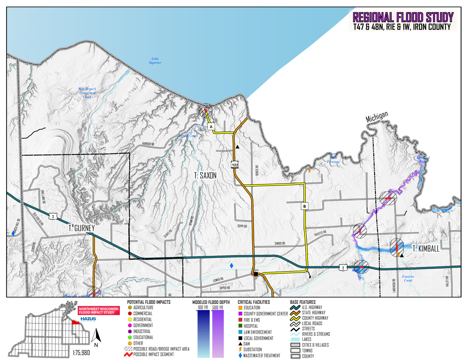
With the use of data from Lidar surveys, the commission modeled the flooding risk to communities in the seven-county region affected by the 2016 and 2018 storms. The idea was to give officials as much information as possible to prioritize future flood mitigation projects, according to the commission's deputy director, Jason Laumann.
The study modeled the effects of a 100-year storm and a 500-year storm across the entire region, and Laumann said the results were strikingly similar to the local effects recorded in the 2016 and 2018 floods. This modeling focused on risks to private property and public infrastructure, and gives communities a starting point to prioritize buyouts and make strategic investments in improving roadway stream crossings, he added.
"This is also a tool to leverage grant funding," Laumann said. "Looking for opportunities to get federal dollars [and] state dollars for projects, retrofitting, further flood studies and greater analysis."
Perhaps the only local government that has considerable funding of its own to put toward flood mitigation is the city of Superior, which experienced heavy flood damage primarily in 2012.
Superior's funding comes by way of Enbridge. The port city is a hub for its continental pipeline system that carries one-fifth of all U.S. daily crude oil imports, and a state oil terminal pipeline tax generates millions of dollars in revenue for the city annually. In 2018, tax revenue from the pipeline was equal to more than 20% of the city's $30 million operating budget, according to Mayor Jim Paine.
He said stormwater management is the city's most pressing climate-related infrastructure problem.
"It's ironic because obviously fossil fuel production and use is the main culprit for causing climate change," Paine said. "It's also, however, what we're using to build the resiliency that we need to meet the dangers of the climate crisis. So, I mean, maybe that's irony [or] maybe it's just a sort of perfect justice, but that's the money that we use."
Meanwhile, environment-focused nonprofits and research institutions are also getting involved. The Wisconsin Wetlands Association is promoting the re-establishment of wetlands, as well as reconnecting streams and rivers to wetlands where possible. It's part of a region-wide effort to "slow the flow" of runoff entering rivers and ultimately Lake Superior. Local governments are on board with the effort, seeing wetland reclamation as another tool for protecting infrastructure, but it is expensive.
The Lake Superior National Estuarine Research Reserve in Superior, a National Oceanic and Atmospheric Administration-affiliated research and outreach program of the University of Wisconsin System, also promotes wetlands as a means for flood control. The program is planning a partnership with The Nature Conservancy in Wisconsin to train people in local governments and others on the use of its "Wetlands by Design" tool, which assists in prioritizing sites for restoration based on outcomes like flood mitigation. The Reserve also works with the city of Superior to train contractors in the Twin Ports region about best practices for reducing erosion and surface runoff during storms and floods.
"Especially in the context of the predicted future of more extreme storms, and based on what we have anecdotally been experiencing over the last seven or eight years, this has really resonated with the local construction contractors," said Karina Heim, the Reserve's coastal training program coordinator.
Another nonprofit whose mission might not at first seem all that related to road infrastructure is the Superior Rivers Watershed Association. The organization works closely with the U.S. Fish and Wildlife Service and the National Fish and Wildlife Foundation to improve habitat for native brook trout by expanding fish passage in Lake Superior tributaries. Since 2014, the group has used grant funding to replace culverts along Wisconsin's Lake Superior shoreline that were impeding the passage of fish, primarily brook trout, to upstream habitat.
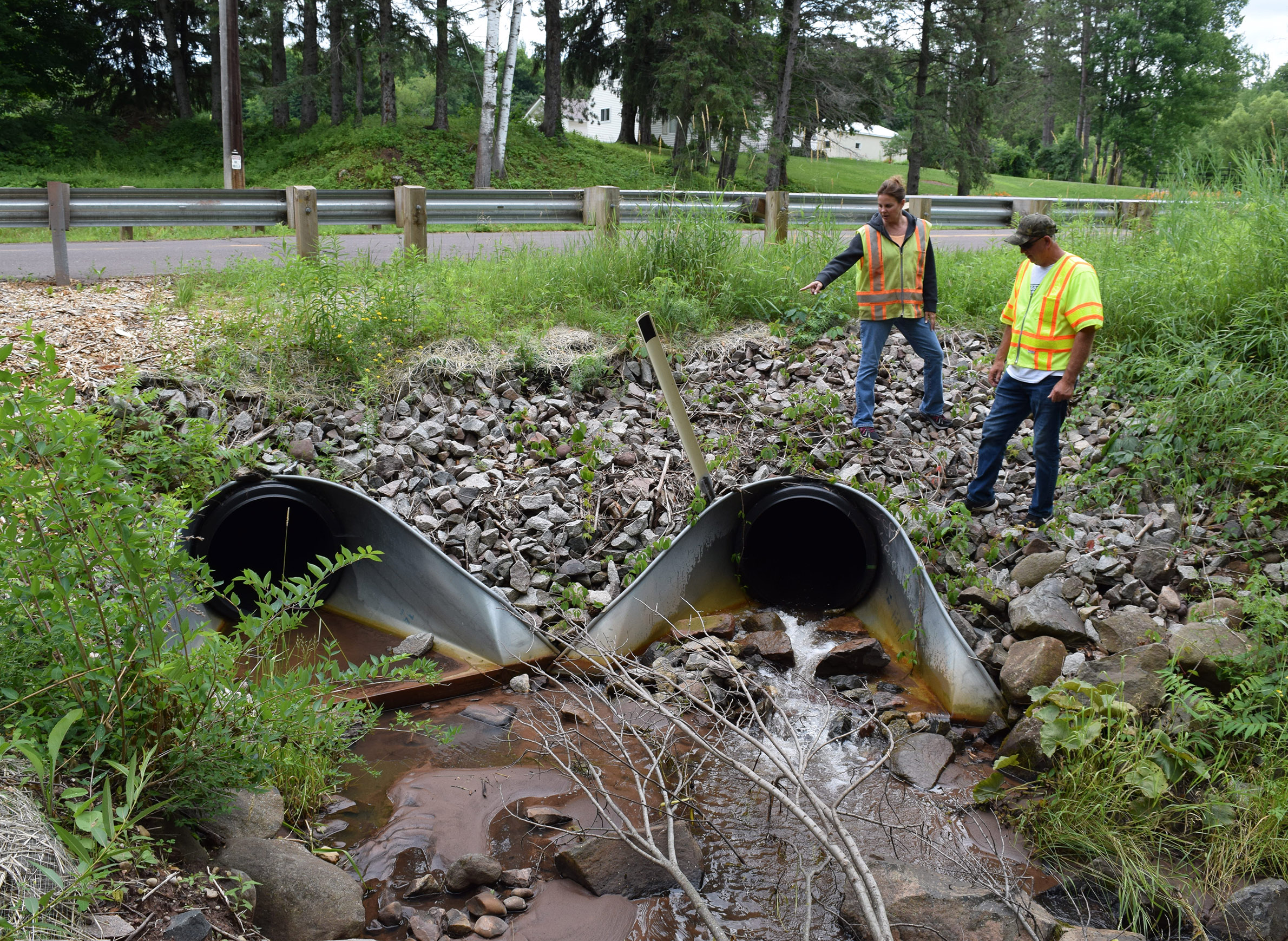
The 24 culverts built so far are generally larger than the ones they've replaced and have shown much better resilience to flooding than older ones, said Kevin Brewster, who manages the program.
"At the time of the 2016 flood, the worst in the region, we had about 18 culverts in the ground and we lost two," Brewster said. "They did extremely well because they were designed right."
Brewster said the group, which also works with local tribes, the DNR and National Park Service, has plans to replace more culverts and continues to apply for more grant funding to fund this work.
At a legislative level, a new bipartisan effort in Congress may affect how federal agencies like FEMA prioritize funding for disaster relief. A bill introduced in the U.S. Senate, which is cosponsored by Sen. Tammy Baldwin, a Democrat from Wisconsin, would direct the Federal Highway Administration to factor in resiliency as it awards disaster recovery grants to local governments. The bill follows a 2018 audit of the highway administration's emergency relief program that highlighted problems with how the program awards and tracks funds for infrastructure resilience and upgrades.
The bill would also establish a formula and grant funding to support transportation projects that "improve the resiliency of roads and bridges to natural disasters and extreme weather events," according to a press release from Baldwin.
It is unclear exactly how the bill, which passed a Senate committee vote in July 2019, would affect how FEMA prioritizes disaster funding in the future were it to become law.
Bracing for what comes next
For many local officials and residents of northwestern Wisconsin, the hope is that funding can someday catch up with their monumental need to build climate resiliency into roads and other infrastructure, and that they won't have to continue to rebuild the same structures every time a big storm hits simply because of a lack of willpower to alter what they view as deeply problematic rules.
In northern Iron County, Joan Elias shared her deep interest in the natural resources surrounding her home. That passion has led her to volunteer in roles that let her be outside while providing a useful scientific service, roles such as stream monitoring near her home.
"There's a culvert crossing where I did volunteer water quality testing upstream of Vaughn Creek," Elias said, describing a moment after the 2016 storm. During the course of her water quality testing, she observed severe damage to this culvert — damage that had previously been overlooked and would in all likelihood cause problems during the next big flood. Her understanding was that FEMA had, in fact, declared the culvert to be fixed.
"The culvert looked fine from above, but I saw that the bottom edge of it was curled in like a lip and there were boulders in there," she said. "Our town chair really had to argue with FEMA around that one. It was because of my observation that FEMA believed him."
In the end, the agency funded the culvert's repair, Elias said, though she wished it had agreed to replace it with a larger one.
"Whatever we can do to keep floods from getting worse," she said.
Washed Away: Northwest Wisconsin Copes With The Costs Of A Changing Climate was originally published on WisContext which produced the article in a partnership between Wisconsin Public Radio and Wisconsin Public Television.
Memberships
Finding Help for Flooded Families and Farms
Steve is a member of LION Publishers , the Wisconsin Newspaper Association, the Menomonie Area Chamber of Commerce, the Online News Association, and the Local Media Consortium, and is active in Health Dunn Right.
He has been a computer guy most of his life but has published a political blog, a discussion website, and now Eye On Dunn County.





Add new comment